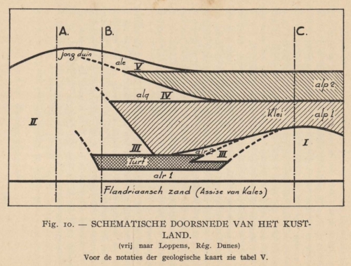
 De Langhe (1939, fig. 10)
Beschrijving Schematische doorsnede van het kustland. (vrij naar Loppens, Rég. Dunes) Voor de notaties der geologische kaart zie tabel V.
JPG bestand - 724.61 kB - 1 327 x 1 009 pixels
toegevoegd op 2012-07-24654 viewsUit bron Le Bot, S. et al. (2004). Optimal offshore wind energy de... (pagina 55)
This work is licensed under a Creative Commons Attribution-NonCommercial-ShareAlike 4.0 International License
Klik hier om terug te keren naar miniatuurweergave |


